Welcome Inspire Pilots!
Join our free DJI Inspire community today!
Sign up

GigaPixel Panorama Using Inspire-1 and Autopano Pro/Giga

Joined
Apr 14, 2015
Messages
61
Reaction score
23
Age
57
Location
Amstelveen
Website
www.hobbypiloot.nl
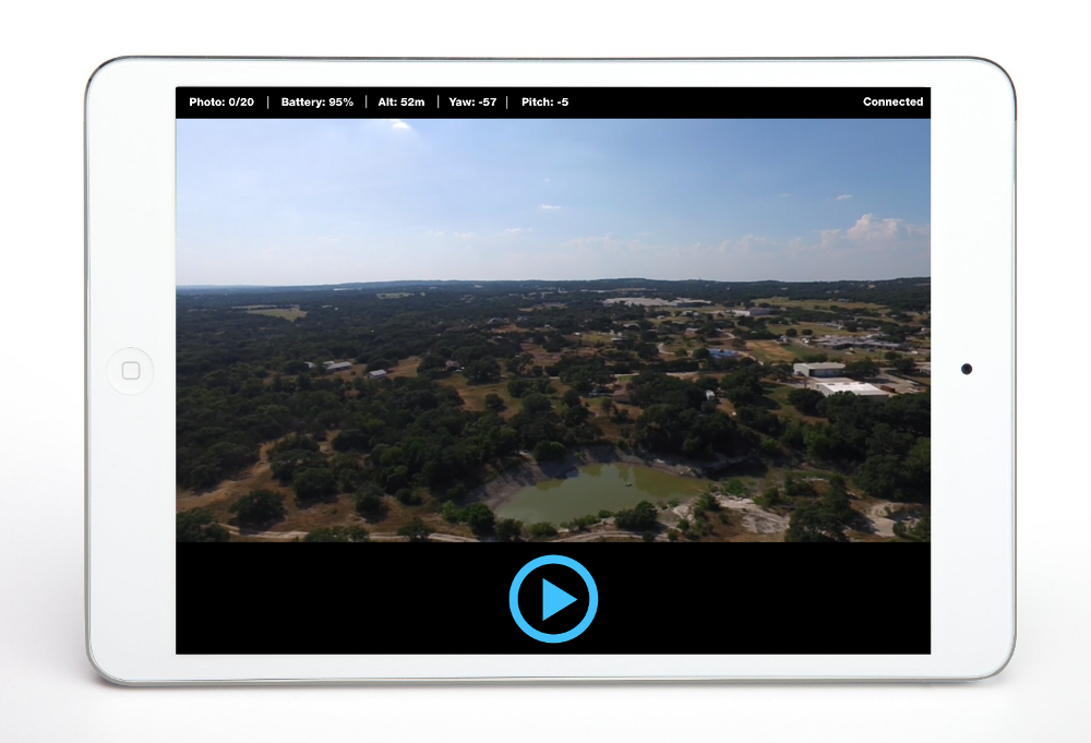
I want to create GigaPixel Panorama shots (reverse sphericals) using the Inspire-1 and publish them on a website using HTML5 (so that all device can use them). In one flight I want to fly to 10 points and take one set of photo's on each point. This allows me to create/publish interactive pano's from the sky e.g. of theme parks, golf courses/holes, yacht clubs, tourist attractions etc, showing multiple viewpoints/highlights. Users then can browse/zoom-in to their favourite spot (e.g. their own boat/caravan). Once we get waypoints on I1, I could even pre-program the whole flight,

I have looked into a one-shot-360 panorama using a spheric lens (e.g. http://www.pano-pro.com) and concluded that the picture quality will not be good enough for a GigaPixel Photo (I really want my viewers to be able to zoom in). So instead, I intend take multiple rows of 12MP photos and stitch them together. I think i have found a solution to stitch and publish the panorama's. The virtual tour software (with GigaPixel support) of www.kolor.com should be able to do the trick. It auto rotates the pano so the output is not as boring as a still.

The Camera should start facing slightly up and take a couple shots while turning 360 degrees (from one end point to the other end point). Then it should tilt down and do another round of shots. Then I should face down and take a last shot. This should be good enough for a reverse spherical photo (I don't want the viewers to be able to see the props of my I1).

I think I have a couple alternatives:
  1. Take the shots manually using the I1 camera (will lead to messy result and a lot of post-work)
  2. Mount a Panoramic Head with a separate camera underneath the I1 (e.g. a GoPro Auto-Pano solution)
  3. Program the Drone camera using SDK to take burst shots whilst it turns.
The best (but also the most difficult) option is most likely is to use SDK.

Also, I guess a tele-lens is probably more useful so that I can create many detailed small-angle shots, rather than a few wide angle shots.. Do any of you know of a tele-converter that may be screwed on the I1 kit camera (for this purpose I don't need FPV on my iPAD, I keep the drone in Line of Sight anyway)?

Has anyone ever done anything like this using SDK? Are there any alternatives that I may have overseen or that you would recommend?

Thanks for your advise/experience.
 
Last edited:
have you made any headway with this yet?

I made a panoramic with kolor software last week, the results were not bad.... not a huge amount of zoom available, but I stitched 100 photos and you cant see a single stich line as far as I can tell
 
Indeed, the solution proved to be very simple, it did not cost me anythin, it did not add any weight to the Inspire-1 (which would cost battery time) nor do i loose warranty of DJI by modifying the drone. I simply enlisted into the Beta Test of DronePan App for Inspire-1 made by Dennis Baldwin.

DronePan is an app that runs on IOS. It does two things using the DJI SDK for Inspire:

1) Show basic FPV information (cam-video view, battery status, height, pitch and yaw), so you can use it, to fly to your Point of Pano and back
2) Automatically take 20 photo's, in four rows. Drone stands still,Inspire-1 gimbal pans/tilts automatically (as if it is an automatic electric pano-head)
  • First Row: 6 photo's, horizontally 60 degrees separated, camera facing forward (0 degrees)
  • Second Row: 6 photo's, horizontally 60 degrees separated, camera facing slight downward (-30 degrees)
  • Third Row: 4 photos, horizontally 90 degrees separated, camera facing downward (-60 degrees)
  • Fourth Row, 2 photos, horizontally 180 degrees separated, camera facing fully downward (-90 degrees)
The pictures are stored on the SD card as per usual. Taking the serie of 20 12MP fotos using DronePan takes 90 seconds. Since I1 used a FOV of 94 degrees horizontally and 53 degrees vertically, only the edges of the photos overlap. This reduces unwanted removal of perceived ghosts (moving objects that are appear to be visible in multiple shots) in Autopano Giga Pro. The reduced number of pictures also speeds up the Automated stitching process significantly. One hardly has to manually tweak the connection points anymore and the blur caused by multiple overlapping pictures is minimised.
screen2.png

You don't need special DJI firmware, I use the latest 1.3 FW and it works fine. If you don't like flying with DronePan FPV, you can fly to point-of-pano (and back) using DJI GO App and just switch to DronePan App when the drone has arrived at the Point-of-Pano, activate the automated photo-shoot in DronePan App and switch back to DJI GO and go home (or to the next POP) when it is finished.

i would have appreciated an extra row of 6 pictures with the camera facing 30 degrees upwards (to do the shots in the middle of a valley with the top of the mountains still being visible in the pano-view). I have asked Dennis if he would consider an extra top-row of photo's in the next release.

If you don't want the shots that may have the legs in the picture, just don't use them,. I would have added distance from pilot and GPS coordinates in the FPV screen. Future improvements would be linkage to Autonomous Flight (e.g. 4 waypoints, on each waypoint 26 shots) to automate the whole process from start to landing. Since SDK for I1 is approx. the same as for P3, probably i would have rotated the drone rather than the gimbal. Then DronePan can use exactly the same app for P3 as for I1 and the chance of legs in the picture would be reduced (for P3 probably you would see shades of rotor blades in top pictures but Autopano would probably fix that in post).

Using DronePan I can take 4-6 series of photos on different locations/heights in a single Inspire-1 flight. The picture overlap is good and processing the automated pics to 3D spheres works better than processing the (often too many) shots that i used to take manually. Of course it is great that iI now don't have to buy a pano-head for 500 US$ plus a decent 12MP action-camera for 400 US$.

BEST OF ALL: The automated process allows me to do a standard 3D DronePano Project in approx. 1-2 hour (excl. travel), including creation/uploading of the 3D DronePano. I now can take 4-5 series of shots on a single battery. With the manual approach I had more work taking the shots (bigger margin for error), I could only do 2-3 decent pano's on one I1 battery, I lost photo details (since i had too much overlapping photos, I often lost "ghosts" e.g. walking golf players, that were removed/faded-out by Autopano) and I had far more work stitching the photo's correctly. A manual 3D DronePano previously took me roughly 2-3 hours per viewpoint. I.e. this great free-bee app saves me 60% time!!!

I totally agree with you that AutoPano Giga Pro provides great results. Yes, the license fee of AutoPano Giga Pro plus AutoTour is rather high. However, when comparing the end results of Autotour with the same pictures being processed in PTGUI, the Autotour Giga VR tours are far better (e.g. no blurs/fades when moving around on the pano). Furthermore, the interactive/media features of Autotour are also superior. The higher kolor.com license fee would only add a couple bucks to the price per VR tour, If one would do a decent amount of pano's per year. On the other hand, PTGUI has one GUI for both the stitching as well as for the creation of VR tours. This would save some time in post processing. For me: the difference in quality/feature was worth the use of having to use two kolor.com apps instead of one of PTGUI app.

If you would only use 20 shots rather than 100 shots per series, you would probably also get a sharper/better result. And indeed, 300% zoom is the max. that you can do with this 12 MP/94 degree FOV setup. More zoom in this setup would only lead to extra size but the highest zoom would be at a really bad quality. Of course you could fly closer to the point on which you expect people to want to zoom in on, and create another pano on that spot and link the pano's together in Panotour Pro.
 
Last edited:
  • Like
Reactions: Ascender

I had seen this drone pano solution on youtube just before you mentioned it.
I will enlist in the beta and have a go, I have already started playing with the kolor products and will make a test at referencign one pano inside another today in panotour.

I was really looking for peoples experience with the auto gimbals that are out there though so that photo quality can be improved. anyho,,,,, this looks like a good starting place,
 
I think better quality can be obtained if a longer lens would be used instead of the kit lens. Then Field Of View is reduced whilst number of pixels on the sensor stay the same. I.e. if one would use 300 mm. with a FOV of 11 degrees (which would be silly), you need 40 fotos of 12 MP per row to cover 360 degrees (i.e. total of 100 photo's for a complete sphere). This would lead to a gigapixel pano that would allow 1500-2000% zoom (rather than max. 300%).

  • A simpler solution is using the Inspire1 HD Camera Modified 5.4mm-Inspection Zoom Lens by Ragecam (1.149 US$). This would allow zooming in on the pano up to approx. 600-700%.
  • If that's not enough; you could go for a DJI S900 or DJI S1000 with a Gimbal and Canon MKII with a 200-300 mm lens (which will be very costly 8.000-9.000 US$).
  • You could also go for a Panohead for Inspire-1 with a GoPro with a zoom lens (which would cost 495 Euro plus a RageCam modded GoPro Camera, which will set you back 1000 US$).
 
Last edited:

Members online

No members online now.

Forum statistics

Threads
22,277
Messages
210,655
Members
34,330
Latest member
GRQLarae44