Welcome Inspire Pilots!
Join our free DJI Inspire community today!
Sign up

Needed: LOW ALTITUDE DJI Pilot app software enhancements

Joined
Jan 23, 2015
Messages
19
Reaction score
3
Age
73
Location
Hickory
Website
www.unifourpeds.com
Needed: LOW ALTITUDE DJI Pilot app software enhancements (including Minimum Altitude setting) - REDUCE CRASHES

... (Original (old) document: http://www.unifourpeds.com/Neede ... de_enhancements.pdf)
NEW PDF - 3RD REVISION: As of 6/16/2015, see this link instead: http://www.unifourpeds.com/Needed_DJI_Inspire_low-altitude_enhancements_REVISION_3.pdf
Or Word Document: http://unifourpeds.com/Needed_DJI_Inspire_low-altitude_enhancements_REVISION_3.docx


This became more of an issue after I crashed my Inspire 1 at 30+ MPH into a very tall tree after repeated S-turns maneuvers inadvertently dropped be to a lower altitude than expected. I now face an 8 week minimum time before I receive my repaired Inspire back from DJI service. This will force the cancellation of at least 8 -12 planned photo shoot excursions.

Consider these relatively easy DJI Pilot software feature enhancements, most of which are already common on military drones and on manned commercial, military and some civilian aircraft. These needed software enhancements, which would prevent about 95% of such low altitude-related Inspire (and Phantom 3) crashes/accidents or damage to others and to property (and would help to reduce your critical repair backlog of Inspires to repair).


Please seriously consider these additions (or at least some of them). Please help us lobby for these needed software enhancements. This is particularly important in photo/video work, land surveys, and search and rescue operations, where “Map View” is utilized significantly during flight by the actual pilot, and in situation where the camera is not in FPV use or used (taken over) by the second controller (camera) operator, or is down-facing. These are high-risk situations for Inspire (or Phantom 3) survival, especially at distant operation where direct visualization is difficult or obstructed for the pilot of the aircraft or when the camera is in non-FPV flight direction, or being used by another video camera operator.
 

Attachments

  • Needed_DJI_Inspire_low-altitude_enhancements.pdf
    301.4 KB · Views: 27
Last edited:
well though I would support this i think v2 needs a proximity sensor to avoid obstacles and would be much better - set the proximity to 1m/3feet and it creates a virtual halo in all directions from center and wont go near anything ... this would be a real enhancement ...
 
  • Like
Reactions: Highflyguy
I agree that, theoretically, such a proximity sensor (virtual halo) that you visioned would be great, but no such sensor hardware exists in the Inspire, nor in any other drone anywhere. The expense, power consumption, and weight would be prohibitive, even if it existed.

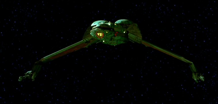
Fortunately, all proposals/options discussed in my attachment SEE ATTACHED PDF below relies on the existed hardware of the current production-model Inspire (and Phantom 3), and are simply practical and realistic enhancements in the DJI Pilot app software. The software enhancements that I suggested (as a stimulus for discussion) are all immediately software achievable with existing Inspire 1 (or Phantom 3) production models, with the possible exception of some of the last ultrasonic flight near-ground altitude prohibition. This document attached NEW PDF - 3RD REVISION: As of 6/16/2015, see this link instead: http://www.unifourpeds.com/Needed_DJI_Inspire_low-altitude_enhancements_REVISION_3.pdf is a collated summary of ideas brought forth by various DJI and Phantom pilots, many of which are also "manned" aircraft pilots, or familiar with commercial or military drones. We have analyzed all the Inspire crashes (or close calls) that we could find, and we have concluded that these are the KEY enhancements to drastically reduce crashes (probably by 95%). especially in flight conditions described in my last post. These are all absolutely do-able according to these experts and according to the software engineers who have reviewed these proposals, and there would be NO HARDWARE EXPENDATURE. One has to be practical, and this proposal is. Be cost-effective! After all, the Inspire 1 is a $3000 drone and not a $3 million dollar drone. We don't have the budget of the Klingon empire, although the Inspire does share some visual similarities to a Klingon Bird-of-Prey.
latest


... (Original (old) document: http://www.unifourpeds.com/Neede ... de_enhancements.pdf)
NEW PDF - 3RD REVISION: As of 6/16/2015, see this link instead: http://www.unifourpeds.com/Needed_DJI_Inspire_low-altitude_enhancements_REVISION_3.pdf
Or Word Document: http://unifourpeds.com/Needed_DJI_Inspire_low-altitude_enhancements_REVISION_3.docx


Software is free, however, providing DJI R&D takes the effort to make these (or at least some of these) software development ideas a reality, then this would bypass the need for waiting for "the next DJI model". All of these enhancement have one primary goal in mind, to drastically reduce the number of Inspire 1 (and Phantom 3) crashes or near crashes in low altitude situations (probably by 95%), especially in non-optimal flying scenarios. Als previously stated, this is particularly important in photo/video work, land surveys, and search and rescue operations, where “Map View” is utilized significantly during flight by the actual pilot, and in situation where the camera is not in FPV use or used (taken over) by the second controller (camera) operator, or is down-facing. These are high-risk situations for Inspire (or Phantom 3) survival, especially at distant operation where direct visualization is difficult or obstructed for the pilot of the aircraft or when the camera is in non-FPV flight direction, or being used by another video camera operator.
 

Attachments

  • Needed_DJI_Inspire_low-altitude_enhancements.pdf
    301.4 KB · Views: 1
Last edited:
David: I think you make some good points. I wonder whether the solution to several of the problems would be to have a separate FPV video feed for the pilot with on-screen display of altitude? That's certainly what I use on a Cinestar so that the payload camera operator can do what they please but I can always see what the aircraft is doing. It is also very disconcerting for me to switch to an Inspire 1 and then effectively lose FPV when the camera op needs to do "look down" mode for whatever reason.

If you utilize the HDMI output from the pilot's transmitter, you'll discover that there is an artificial horizon, plus some basic telemetry which includes height-above-take-off-point, distance to home, and X/Y velocity. Worth a look. I use non-isolating Cinemizer goggles -- non-isolating in the sense that I wear them on the far side of corrective glasses and I can see above them for visual line of sight of the aircraft for all flight phases, and below them to see the screen of an iPad.

One minor issue with your proposals is that they are somewhat vitiated by non-level terrain -- the pressure sensor on the I1 will only ever give you height-above-takeoff point -- where what you're proposing would be maximally useful if you had height-above-local-terrain. This does not detract from your proposals, but does serve to raise food for thought. Won't be long before we get decent radar altimeters (probably by the Inspire 23? :) )

Andy.
Andy, I agree with your comments about the problems encountered with the Inspire when trying to share one camera for both piloting and videoing. Thanks for your interest.

Like most of pilots, I feel much more comfortable in FPV and/or direct view of the Inspire, and in most cases, that's how I fly. But that's not always possible when the Inspire is used as a camera platform, performing tasks with that goal in mind, and sometimes without someone available or trained for the Inspire's second camera controller.

EXAMPLE - Search and Rescue: The problem is that when you are in a Search and Rescue (or similar) scenario (often, by necessity, with missions put together quickly), you fly in camera down position, shooting 4K, and run continuous S-turns to cover sequential 20-40 acre search grids (usually flying low and fast, just above the trees), sometimes in unfamiliar territory, sometimes with non-flat terrain, often without another individual to run the other Inspire's second camera controller, and having to do all this entirely in "Map View" (so as to be thoroughly cover the search grid). You switch micro-SD card and battery after each search grid, and take off again (someone analyzing the past card's video while the pilot is flying again). I crashed my Inspire doing this, inadvertently dropping the altitude into a tree 70 feet up.

It is simply too much to handle without risk of pilot error (especially when continuous S-turns with the left stick is shared with up/down altitude) ... it's far too easy to inadvertently drop the altitude down enough to hit a tree. And yes, Andy, it would be nice to have a minimum altitude warning and/or prohibition set as altitude above ground (instead of altitude above "home" point), but the sensors simply are not there (yet - perhaps with the Matrice 100 technologies to be developed). Or ? perhaps the Inspire's altitude-above-ground could be tied to the "ground altitude" (at the Inspire's position) derived from the map?

Although this example is not the usual flying situation, it's probably the most compelling example of the need for the enhancements enumerated in the attached document. Please help us to improve these enhancement recommendations: NEW PDF - 3RD REVISION: As of 6/16/2015, see this link instead: http://www.unifourpeds.com/Needed_DJI_Inspire_low-altitude_enhancements_REVISION_3.pdf

Dave Millsaps
828-320-5152
 

Attachments

  • Needed_DJI_Inspire_low-altitude_enhancements.pdf
    301.4 KB · Views: 1
Last edited:
  • Like
Reactions: mdomeny
Needed: LOW ALTITUDE DJI Pilot app software enhancements (including Minimum Altitude setting) - REDUCE CRASHES

SEE ATTACHED PDF in this link:
http://www.unifourpeds.com/Neede ... de_enhancements.pdf

This became more of an issue after I crashed my Inspire 1 at 30+ MPH into a very tall tree after repeated S-turns maneuvers inadvertently dropped be to a lower altitude than expected. I now face an 8 week minimum time before I receive my repaired Inspire back from DJI service. This will force the cancellation of at least 8 -12 planned photo shoot excursions.

Consider these relatively easy DJI Pilot software feature enhancements, most of which are already common on military drones and on manned commercial, military and some civilian aircraft. These needed software enhancements, which would prevent about 95% of such low altitude-related Inspire (and Phantom 3) crashes/accidents or damage to others and to property (and would help to reduce your critical repair backlog of Inspires to repair).


Please seriously consider these additions (or at least some of them). Please help us lobby for these needed software enhancements. This is particularly important in photo/video work, land surveys, and search and rescue operations, where “Map View” is utilized significantly during flight by the actual pilot, and in situation where the camera is not in FPV use or used (taken over) by the second controller (camera) operator, or is down-facing. These are high-risk situations for Inspire (or Phantom 3) survival, especially at distant operation where direct visualization is difficult or obstructed for the pilot of the aircraft or when the camera is in non-FPV flight direction, or being used by another video camera operator.

SEE ATTACHED PDF in this link: http://www.unifourpeds.com/Neede ... de_enhancements.pdf
I am not sure whom you wish to lobby but what you are suggesting just isn't going to happen.
The current platform does not have the necessary hardware to support the accuracy you are after.
All of your requests are altitude requirements and the Inspire only has a solid state barometric pressure sensor to measure changes in atmospheric pressure which it translates into 'altitude' above (or below) its take off point which it classes as zero. Whilst the sensor has an resolution of around 10cm it is not an exact science and fairly large errors in height are the norm. (The sensors exhibit drift and change with thermal differences)
Additionally GPS is worse than useless for altitude measurements and can be out by +/- 400 feet on occasions depending on hdop/vdop.
The ultrasonic transducers are not powerful enough to give anything but a reflection of a few feet off the ground and the whole optical flow system can be fooled very easily by anything that moves. It was never designed to deal with moving targets but simply 'lock onto' a static pattern or feature to enable the Inspire to hold position indoors or when GPS was not available.

To get what you are after is outside of the paygrade of the Inspire and you would need to spend many times over the cost of the I1 to achieve those requirements.
 
Thanks Editor (I assume that you are the editor for InspirePilots). I appreciate your comments.

The enhancements items subsequent to my original post have escalated considerably from my original document. Note in my second post, we made the comment "Be cost-effective! After all, the Inspire 1 is a $3000 drone and not a $3 million dollar drone.". And, yes, ground proximity radar on a commercial/military aircraft is in a totally different league as this, but all we need is BASIC altitude for the various enhancements in the original document ... we are just having the software provide us additional (optional) warning and some (optional) limitations, but no hardware changes (based on data already being generated by existing sensors) The enhancement accuracy need only tell me if I am say less than 200 feet above takeoff point. As I pointed out in a previous post reply "The expense, power consumption, and weight would be prohibitive, even if it existed". And, yes, I section 2d of the document, as I indicated in the original document, would probably NOT work, because of the limitations of the ultrasonic transducer.

... (Original (old) document: http://www.unifourpeds.com/Neede ... de_enhancements.pdf)
NEW PDF - 3RD REVISION: As of 6/16/2015, see this link instead: http://www.unifourpeds.com/Needed_DJI_Inspire_low-altitude_enhancements_REVISION_3.pdf
Or Word Document: http://unifourpeds.com/Needed_DJI_Inspire_low-altitude_enhancements_REVISION_3.docx


Please go back to the original document, where, according to the DJI folks (that I have discussed this with), all but the last item (as I indicated) are achievable. Admittedly, the accuracy of such altitude measurements is limited, but, nevertheless, these basic software enhancements in the document are readily achievable with existing hardware only (no additional or more accurate sensors or systems) and using only the existing altitude measurement estimates. Please read this document over carefully, and note that these are only "BASIC" changes that do not require accuracy of altitude measurements, but would nevertheless, if instituted, prevent many of the Inspire altitude mistakes that lead to crashes. This does NOT, for instance, solve the problem of inaccurate pilot estimate of a distant hill elevation, whose trees were higher than say the estimate of 160 feet above "home" take-off point. Again, we are just having the software provide us additional (optional) warning and some (optional) limitations, but no hardware changes (based on data already being generated by existing sensors)

I can be contacted directly at 828-320-5152, David Millsaps, Hickory NC, mailto:[email protected]
 
Last edited:
To me the problem is not where you see it.

Firstly the source issue:
EXAMPLE - Search and Rescue: The problem is that when you are in a Search and Rescue (or similar) scenario (often, by necessity, with missions put together quickly), you fly in camera down position, shooting 4K, and run continuous S-turns to cover sequential 20-40 acre search grids (usually flying low and fast, just above the trees), sometimes in unfamiliar territory, sometimes with non-flat terrain, often without another individual to run the other Inspire's second camera controller

Then sorry but IMO you're just "doing it wrong", you should organise yourself to always a 2nd operator.

From a practical point of view you could instead use another machine that is more appropriate for the purpose and has waypoint capabilities so you can select your area, autogenerate a grid at a given safe altitude and let it fly itself while you look at the image, but then both this and your current way of operating are currently not considered safe and are illegal in most places as the pilot should always be looking at the machine.

Then to the theory...
This became more of an issue after I crashed my Inspire 1 at 30+ MPH into a very tall tree after repeated S-turns maneuvers inadvertently dropped be to a lower altitude than expected.
This just invalidates your entire document and set of suggestions. What you noticed is the I1's altitude hold inaccuracies, precisely when doing that kind of maneuvers the machine may indeed drop a few meters, with the altitude measurement drifting a bit until you cut down on the "complex" movements for a few seconds, where it slowly recovers and gets back up. So your limits would be of no use because the measurement is wrong in the first place.
 
Thinking out of the box how about something like a lazer measure that could fit on the back of the inspire as an add on. It could say fire a beam off every 2 seconds and transmit it to the software some how. Just saying.
 
That would have a bit more range than the sonar but still has the same limitations of not being reliable depending on the surface below or when the aircraft is not flat.
 
there is jello in their gimbal... [emoji14] naaahhhh...
flight times and other specs seem good... not for filming... but that is stated... anyone care to say what SAR means?
 
There is no question the the crash of my Inspire was entirely my fault. I was flying solo, with no one else around (and tired - big mistake!), and made a series of errors detailed below:

I was in DIRECT sight of the aircraft almost all of the time , but is hilly country, and heavily forested terrain, the view was temporarily partially blocked by a nearby tree during the S-turn, and as I was repositioning myself, looking back and forth between direct view and "Map View", I think I must have accidentally applied some slight down-lever on the left stick (the same stick I was using to make the relatively high-speed but gentle S-turn). (high-speed - another mistake). In the process I inadvertently dropped about 50-70 feet, not much, but enough to hit the only very tall tree in the area, hitting the tree at about 70 feet up (where the Inspire remained lodged). My first crash or even close call in 500 + flights (another error ... becoming overly confident and complacent in my piloting skills).

Nevertheless, the minimal altitude and other low altitude software enhancements/features described in the document would absolutely have prevented this crash, and I would not have to wait 8 weeks for the Inspire to return from repair. From what DJI and other Inspire vendors tell me, many other Inspire pilots (hundreds) have done similar pilot-error altitude-related crashes, and the repair center tells me the same (thus, the 7-8 week backlog for repairs). So if there as a solution which can prevent altitude-related crashes due to "pilot stupidity" or temporary lapse in "judgement" or "attention" (and I will plea guilty here), then all of us win. The minimal altitude feature was actually part of the very early versions of the Inspire firmware/software, but for some reason, they took it out ... not sure why? I assume that there where enough toggles and options involved in these low altitude features, that it was a little bit much to add in all these option to pre-production Inspire (DJI Pilot) releases. However, if 90-95% of altitude-related crashes could be prevented with such enhancements, that it is time to add these (pilot-optional) minimal altitude (and related) features back.

In my case, had I set the relative minimal altitude to be 200 feet (above take-off point - "Home"), this would have been at least 100 feet above the nearest tree, even at a distance from "Home". GPS/GLONASS altitude and barometric altitude sensors on the Inspire have significant inaccuracies (and drift) consistent with the price of the Inspire, but they are not THAT bad to be off by 100 feet. Obviously the use of ground proximity radar would be absolutely ridiculous in a $3000 drone, and it makes no sense to retool the Inspire hardware at this point for other expensive hardware changes. However, there is nothing wrong with using the data-stream already being produced by the Inspire 1 (and Phantom 3), with existing stock sensors/hardware, and having that data being processed by the (updated) DJI Pilot App ... to produce (optional) audible/voice and screen-visual warning and in some case (optional) minimal altitude restrictions that would prevent 90-95% of the crashes! And yes, different pilots, different flight conditions, different levels of skill, etc.may prefer none of this, or some of this, or all of this. That's why we have put all of the various toggles/options in the document attached (and linked:

NEW PDF - 3RD REVISION: As of 6/16/2015, see this link instead: http://www.unifourpeds.com/Needed_DJI_Inspire_low-altitude_enhancements_REVISION_3.pdf
Or Word Document: http://unifourpeds.com/Needed_DJI_Inspire_low-altitude_enhancements_REVISION_3.docx

... (Original (old) document: http://www.unifourpeds.com/Neede ... de_enhancements.pdf)

So please read the document attached, be open-minded, and thoughtful of how we can fine-tune these ideas to be beneficial to DJI, without costing then anything, and without changing hardware and sensor requirements. DJI says that these are all achievable except for item "2D" (as I have already indicated in the document).

Thanks for your help. Fly safely!
 

Attachments

  • Needed_DJI_Inspire_low-altitude_enhancements.pdf
    301.4 KB · Views: 2
Last edited:
There is no question the the crash of my Inspire was entirely my fault. I was flying solo, with no one else around (and tired - big mistake!), and made a series of errors detailed below:

I was in DIRECT sight of the aircraft almost all of the time , but is hilly country, and heavily forested terrain, the view was temporarily partially blocked by a nearby tree during the S-turn, and as I was repositioning myself, looking back and forth between direct view and "Map View", I think I must have accidentally applied some slight down-lever on the left stick (the same stick I was using to make the relatively high-speed but gentle S-turn). (high-speed - another mistake). In the process I inadvertently dropped about 50-70 feet, not much, but enough to hit the only very tall tree in the area, hitting the tree at about 70 feet up (where the Inspire remained lodged). My first crash or even close call in 500 + flights (another error ... becoming overly confident and complacent in my piloting skills).

Nevertheless, the minimal altitude and other low altitude software enhancements/features described in the document would absolutely have prevented this crash, and I would not have to wait 8 weeks for the Inspire to return from repair. From what DJI and other Inspire vendors tell me, many other Inspire pilots (hundreds) have done similar pilot-error altitude-related crashes, and the repair center tells me the same (thus, the 7-8 week backlog for repairs). So if there as a solution which can prevent altitude-related crashes due to "pilot stupidity" or temporary lapse in "judgement" or "attention" (and I will plea guilty here), then all of us win. The minimal altitude feature was actually part of the very early versions of the Inspire firmware/software, but for some reason, they took it out ... not sure why? I assume that there where enough toggles and options involved in these low altitude features, that it was a little bit much to add in all these option to pre-production Inspire (DJI Pilot) releases. However, if 90-95% of altitude-related crashes could be prevented with such enhancements, that it is time to add these (pilot-optional) minimal altitude (and related) features back.

In my case, had I set the relative minimal altitude to be 200 feet (above take-off point - "Home"), this would have been at least 100 feet above the nearest tree, even at a distance from "Home". GPS/GLONASS altitude and barometric altitude sensors on the Inspire have significant inaccuracies (and drift) consistent with the price of the Inspire, but they are not THAT bad to be off by 100 feet. Obviously the use of ground proximity radar would be absolutely ridiculous in a $3000 drone, and it makes no sense to retool the Inspire hardware at this point for other expensive hardware changes. However, there is nothing wrong with using the data-stream already being produced by the Inspire 1 (and Phantom 3), with existing stock sensors/hardware, and having that data being processed by the (updated) DJI Pilot App ... to produce (optional) audible/voice and screen-visual warning and in some case (optional) minimal altitude restrictions that would prevent 90-95% of the crashes! And yes, different pilots, different flight conditions, different levels of skill, etc.may prefer none of this, or some of this, or all of this. That's why we have put all of the various toggles/options in the document attached (and linked: http://www.unifourpeds.com/Needed_DJI_Inspire_low-altitude_enhancements.pdf ).

So please read the document attached, be open-minded, and thoughtful of how we can fine-tune these ideas to be beneficial to DJI, without costing then anything, and without changing hardware and sensor requirements. DJI says that these are all achievable except for item "2D" (as I have already indicated in the document).

Thanks for your help. Fly safely!
David I'm not sure who you are referring to when you say 'we' when you refer to your document. Is it the royal we?
I'm also not sure who you have spoken to at DJI that says all of this (apart from one) are achievable, I am going to assume they were not technical individuals?
Perhaps you can give me their names and I will take it up with DJI?

What I would glean from your posts is that the Inspire may not be the platform best suited to your needs and a modular approach may possibly fit your requirements better. May I suggest you look at either the Matrice 100 which DOES have collision avoidance on all axis or a more bespoke rig that can be tailored to your specification?

What I will say however, is it is highly unlikely any of your 'suggestions' will ever make it to the Inspire other than through the SDK and a third party solution.

As an aside could you please not keep posting links to your document over and over and over again. It is not necessary, once will suffice.

Thank You.
 
Last edited:
There is no question the the crash of my Inspire was entirely my fault. I was flying solo, with no one else around (and tired - big mistake!), and made a series of errors detailed below:

I was in DIRECT sight of the aircraft almost all of the time , but is hilly country, and heavily forested terrain, the view was temporarily partially blocked by a nearby tree during the S-turn, and as I was repositioning myself, looking back and forth between direct view and "Map View", I think I must have accidentally applied some slight down-lever on the left stick (the same stick I was using to make the relatively high-speed but gentle S-turn). (high-speed - another mistake). In the process I inadvertently dropped about 50-70 feet, not much, but enough to hit the only very tall tree in the area, hitting the tree at about 70 feet up (where the Inspire remained lodged). My first crash or even close call in 500 + flights (another error ... becoming overly confident and complacent in my piloting skills).

Nevertheless, the minimal altitude and other low altitude software enhancements/features described in the document would absolutely have prevented this crash, and I would not have to wait 8 weeks for the Inspire to return from repair. From what DJI and other Inspire vendors tell me, many other Inspire pilots (hundreds) have done similar pilot-error altitude-related crashes, and the repair center tells me the same (thus, the 7-8 week backlog for repairs). So if there as a solution which can prevent altitude-related crashes due to "pilot stupidity" or temporary lapse in "judgement" or "attention" (and I will plea guilty here), then all of us win. The minimal altitude feature was actually part of the very early versions of the Inspire firmware/software, but for some reason, they took it out ... not sure why? I assume that there where enough toggles and options involved in these low altitude features, that it was a little bit much to add in all these option to pre-production Inspire (DJI Pilot) releases. However, if 90-95% of altitude-related crashes could be prevented with such enhancements, that it is time to add these (pilot-optional) minimal altitude (and related) features back.

In my case, had I set the relative minimal altitude to be 200 feet (above take-off point - "Home"), this would have been at least 100 feet above the nearest tree, even at a distance from "Home". GPS/GLONASS altitude and barometric altitude sensors on the Inspire have significant inaccuracies (and drift) consistent with the price of the Inspire, but they are not THAT bad to be off by 100 feet. Obviously the use of ground proximity radar would be absolutely ridiculous in a $3000 drone, and it makes no sense to retool the Inspire hardware at this point for other expensive hardware changes. However, there is nothing wrong with using the data-stream already being produced by the Inspire 1 (and Phantom 3), with existing stock sensors/hardware, and having that data being processed by the (updated) DJI Pilot App ... to produce (optional) audible/voice and screen-visual warning and in some case (optional) minimal altitude restrictions that would prevent 90-95% of the crashes! And yes, different pilots, different flight conditions, different levels of skill, etc.may prefer none of this, or some of this, or all of this. That's why we have put all of the various toggles/options in the document attached (and linked: http://www.unifourpeds.com/Needed_DJI_Inspire_low-altitude_enhancements.pdf ).

So please read the document attached, be open-minded, and thoughtful of how we can fine-tune these ideas to be beneficial to DJI, without costing then anything, and without changing hardware and sensor requirements. DJI says that these are all achievable except for item "2D" (as I have already indicated in the document).

Thanks for your help. Fly safely!


My opinion is that a lot can be made on the rc controller side before thinking on more complex sensors and software.

The problem you mentioned for example, I think it's an error to have power and rudder controlled by the same stick (where you need sub-milimeter precision).
 

Members online

Forum statistics

Threads
22,277
Messages
210,655
Members
34,319
Latest member
MaricruzRa