Folks
I, am, confused.
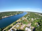
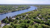
I live in a small town of 3250. In a quiet neighborhood near the edge of town. West Central Mn. Common sense dictates not to annoy my neighbors nor fly where an airplane might be. The last thing I want to do is have folks descend on me and give me trouble. I have a fun, meaningful project in mind for the summer.
I purchased an Inspire I v2 Pro with X5 camera, normal lens. Have learned alot of the drone itself and battery management. It has not seen any flying yet. I have flown RC airplanes for many years on AMA fields.
I am concerned of receiving permission anywhere I fly and inform the Sheriff/Police dept in case someone calls in. They both expressed gratitude. I have checked with the local Airport Manager who mentioned an area outside of town with a good sized field. Even tho the main use of the airport is for the local Agwagon to fly in and out of. With generous clear fields to the west.
I signed up with the FAA for a Recreational Permit. One placed on the Inspire, the other in my billfold. I have started a log. Everything I have done to it, parts ordered, battery conditioning/charging, etc. People called. I am also aware of the Part 107 test. And one day, would find it useful to have. I will also log every flight and download the flight path.
I understand the Rec Permit allows me to fly for my own amusement, make pictures or movies, bring them home and watch them on my monitor. I can not post them anywhere online such as YouTube, Facebook etc. I am not clear if I can post them on my own Website. Which I have. I can not charge nor receive any money for them. I can not even give them away to a NonProfit Organization. Like the local Historical Society. How about my realtives and friends? My wife at work??
Above my house, the iPhone App, B4UFLY says I am "Clear for Takeoff". "No active adviseries. Maintain situational awareness". Btw, it also states that same thing at our airport. (KBB) West Central Mn. And a jail near town.
The DJI GO App tells me on the iPhone Screen I have an airport nearby from the No Fly database. The Jail is highlighted and the Airstrip itself has an Altitude warning. I read of the altitude calcs. So what do I do with that info?
One question I have. VFRMap.com has a five mile radius around airports in my city and neighboring towns. I am confused. Does that mean there is no drone flying within that area?
Another is, the airport mgr mentioned he may have to alert FAA folks in a larger airport nearby of my flights. I am confused as the answers I got were not clear. Really?
I have read of the FAA requiring drones in the near future, to send telemetry thru the Internet to the FAA or their Contractor. That sounds like a good idea. But, I buy a $300 drone at Walmart and ?? What happans if where one flies doesn't have WiFi nor a decent cellular signal? Will that whole thing turn out like the CB radio craze that went from Licensed Operators to anything goes?
Right now, I am really discouraged. Where is the Fun in any of this? Always concerned of the FAA requirements? And may just cut my losses.
Thanks for any help ...
I, am, confused.
I live in a small town of 3250. In a quiet neighborhood near the edge of town. West Central Mn. Common sense dictates not to annoy my neighbors nor fly where an airplane might be. The last thing I want to do is have folks descend on me and give me trouble. I have a fun, meaningful project in mind for the summer.
I purchased an Inspire I v2 Pro with X5 camera, normal lens. Have learned alot of the drone itself and battery management. It has not seen any flying yet. I have flown RC airplanes for many years on AMA fields.
I am concerned of receiving permission anywhere I fly and inform the Sheriff/Police dept in case someone calls in. They both expressed gratitude. I have checked with the local Airport Manager who mentioned an area outside of town with a good sized field. Even tho the main use of the airport is for the local Agwagon to fly in and out of. With generous clear fields to the west.
I signed up with the FAA for a Recreational Permit. One placed on the Inspire, the other in my billfold. I have started a log. Everything I have done to it, parts ordered, battery conditioning/charging, etc. People called. I am also aware of the Part 107 test. And one day, would find it useful to have. I will also log every flight and download the flight path.
I understand the Rec Permit allows me to fly for my own amusement, make pictures or movies, bring them home and watch them on my monitor. I can not post them anywhere online such as YouTube, Facebook etc. I am not clear if I can post them on my own Website. Which I have. I can not charge nor receive any money for them. I can not even give them away to a NonProfit Organization. Like the local Historical Society. How about my realtives and friends? My wife at work??
Above my house, the iPhone App, B4UFLY says I am "Clear for Takeoff". "No active adviseries. Maintain situational awareness". Btw, it also states that same thing at our airport. (KBB) West Central Mn. And a jail near town.
The DJI GO App tells me on the iPhone Screen I have an airport nearby from the No Fly database. The Jail is highlighted and the Airstrip itself has an Altitude warning. I read of the altitude calcs. So what do I do with that info?
One question I have. VFRMap.com has a five mile radius around airports in my city and neighboring towns. I am confused. Does that mean there is no drone flying within that area?
Another is, the airport mgr mentioned he may have to alert FAA folks in a larger airport nearby of my flights. I am confused as the answers I got were not clear. Really?
I have read of the FAA requiring drones in the near future, to send telemetry thru the Internet to the FAA or their Contractor. That sounds like a good idea. But, I buy a $300 drone at Walmart and ?? What happans if where one flies doesn't have WiFi nor a decent cellular signal? Will that whole thing turn out like the CB radio craze that went from Licensed Operators to anything goes?
Right now, I am really discouraged. Where is the Fun in any of this? Always concerned of the FAA requirements? And may just cut my losses.
Thanks for any help ...