Going down the rabbit hole...
I work in conjunction with survey crews. At this point, as far as I know, there's no such thing as a true "drone survey." Even enterprise RTK drones aren't accurate enough GPS-wise to satisfy industry tolerances. 1"/pixel is our minimal accuracy with as little as 1/2"/pixel for some clients.
Drone photos have to be tied to Ground Control Points, that have to be surveyed by a professional surveyor. If you're just making mosaics, then of course accuracy doesn't matter. But if you're making a true "map," then you need to have surveyed GPC's.
That said, I'm not a surveyor. I work for a survey company. So if anybody knows any better, please feel free to chime in.
Worth noting; This partnership between survey company and drone is a house of cards. 50 things have to go right for BOTH of us to deliver a finished, accurate product. Case in point, I did my preflight research and drove 90 miles to a jobsite, set up my spare drone just to be met with this ChinEnglish failure:
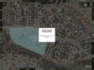
Keep in mind that survey crews had also traveled 90 miles and planted and surveyed a dozen GCP's the day before and were standing by to collect these GCP's post mission. So the entire job hinged on my photos - my flights. Yet here I was staring at a ChinEnglish warning telling me my mission will "across" the no fly zone. As you can imagine, for a second my heart sank into my stomach!
This parcel is over 5 miles from a Class D airport with no NFZ's or NOTAM's for that area for that day. This is just another one of those random, erroneous DJI NFZ bugs that prompted me to hack my drones in the first place. Fortunately for all of us, my MAIN P4P is hacked. I simply put away the spare (I fly the spare occasionally just for grins), loaded the mission into my main P4P and flew the mission. Talk about job security.
A few weeks ago I had another issue. Of the dozen flights I had done that day, ONE mission was *slightly* out of focus. How it works; once the drone reaches altitude, it auto focuses before snapping the first photo. I always watch to make sure the drone goes through the autofocus routine. I learned that day that just because the drone goes through the focus routine does NOT always means that it focuses 100% all of the time.
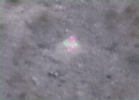
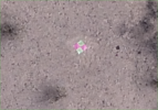
Here's what a properly focused photo of a GCP looks like from 250' AGL (Digitally zoomed):
On this day, ONE of my missions was "soft." This is the result (digitally zoomed):
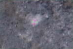
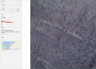
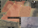
Fortunately, I always "over collect," so there's a little wiggle room for small mistakes. Keep in mind the "soft" photos accounted for < 5% of the total day's collection. But a lesson was learned. I must be VERY diligent regarding focus (which is hard to see in a corner window on a 12.9" iPad:
I guess my point is, if you're going to put all your eggs in a drone basket, you better have a drone operator INTIMATELY familiar with the drone, the software, the firmware and all the inner workings of the process. Despite the rhetoric, there's a lot more to this than simply setting up a Pix4D account, buying a drone and collecting photos.
D


